Please send us an e-mail to info@socompa.com or fill the form
Join the Socompa Tribe
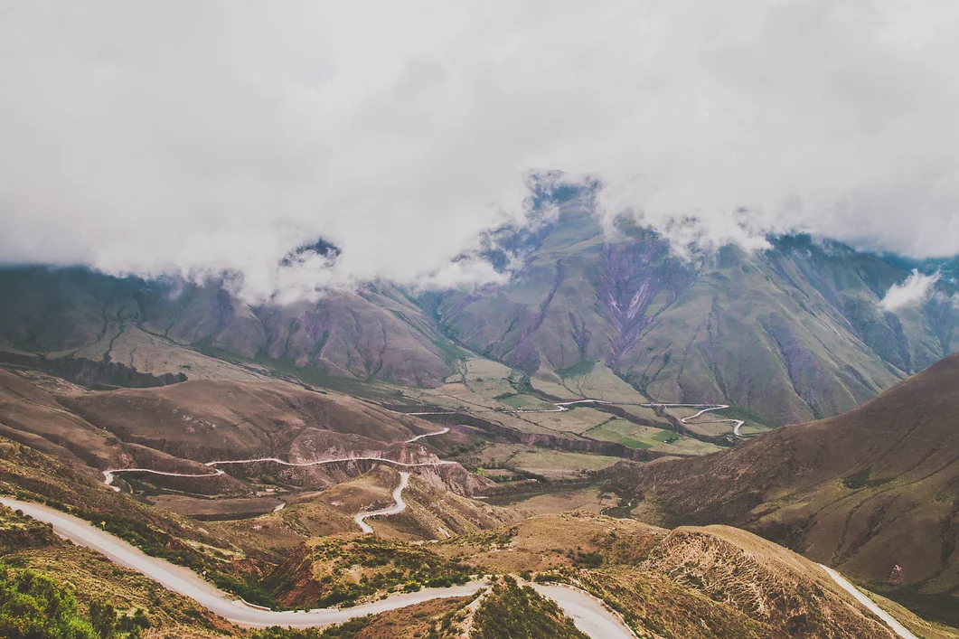
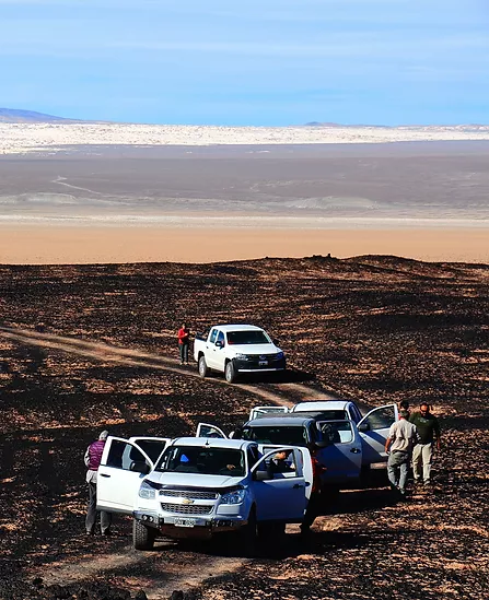
NOA & Puna Experience / Day 1
Salta | Cuesta del Obispo | Cachi | Molinos
Estimated driving time: 4 hs. | Distance: 122 km / 76 ml paved road. 81 km / 50 ml gravel road. | Altitude: Highest point 3.457 m. / 11.342 f. Molinos 2.020 m / 6.627 f. | Meals Included: Lunch.
The road between Salta and Molinos is one of the most spectacular paths of the Argentinean Northwest. We will travel through four different ecosystems, from the green jungle of the yungas forest to the arid desert of the Calchaquí Valley. 33km of mountain will bring us closer to Paso Piedra del Molino at 3.457 meters: condors flying in the blue sky, guanacos and wild burros among thousands of cardones, the local species of giant cactus.
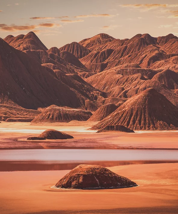
We will have time for a walk in Los Colorados red desert, rarely visited and a moment to relax under a cozy molle tree in the white colonial village of Cachi, where the sun shines almost all year round. We will spend the night in the historical hotel, Hacienda de Molinos.
Molinos | Angastaco | Quebrada de las Flechas | Cafayate | Quebrada de las Conchas | Cafayate
Estimated driving time: 5 hs. | Distance: 100 km / 62 ml paved road. 90 km / 56 ml gravel road. | Altitude: Highest point 2.300 m. / 7.546 f. Cafayate 1.683 m. / 5.522 f. | Meals Included: Breakfast and lunch
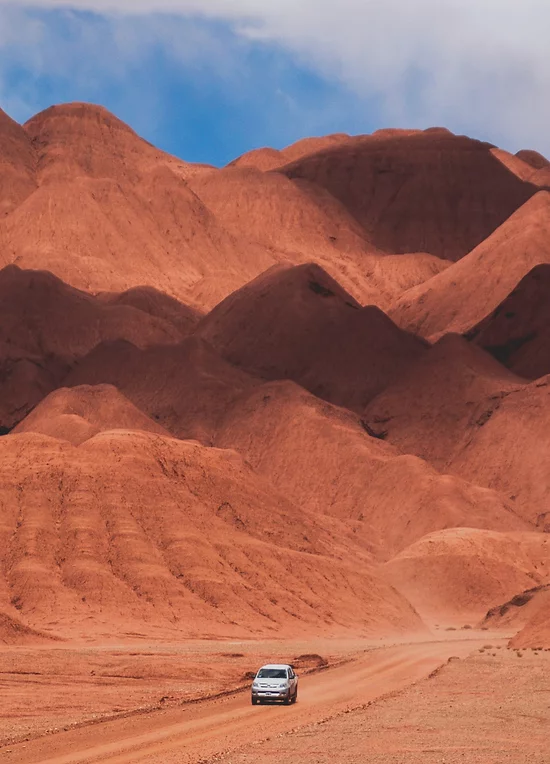
Route 40 is one of the most famous and longest routes in the world. Between the towns of Molinos and Cafayate we will find many little villages populated by local winemakers and farmers, we will drive across the Quebrada de las Flechas, a desert formed by dust of limestone and quartz, eroded by wind and water creating the shape of thousands of Arrow Peaks.
Cafayate is the perfect place for lunch or to visit a traditional winery. Just before the sunset with the best lights of the day, we will explore the Conchas’ Gorge: a deep ravine built in the last 50 million years with huge deposits of minerals (clay and sandstone in particular) molded by water and wind that comes from an age when the region was dominated by a humid and warm climate with animals such as turtles and crocodiles.
a beautiful estancia and wine cellar, also includes a light museum.
Quebrada de las Flechas
Quebrada de las Flechas
Viñas de Cafayate Wine Resort
Cafayate, Salta
Qebrada de las conchas
sunset over mountains and a rainbow across the landscape
Estimated driving time: 5 hs. | Distance: 250 km / 155 ml paved road. 50 km /31 ml gravel road. | Altitude: Highest point 4.050 m./13.287 f. El Peñón 3.400 m. / 6.625 f. | Meals Included: breakfast, lunch and dinner.
Following Route 40 in direction to the south, we will explore one of the most deserted regions of Argentina. In the morning we’ll visit the archeological site of Quilmes, probably the most interesting Pre Inca Ruins of NW Argentina, with a dramatic history that gave an end to its ancient population.
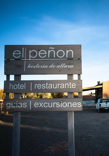
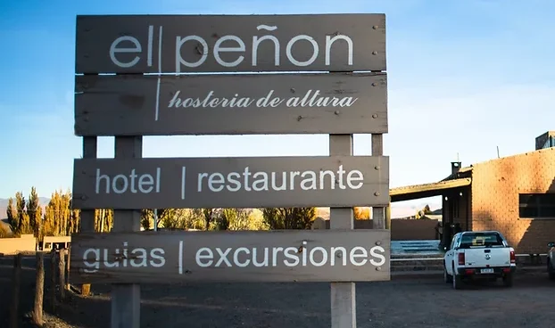
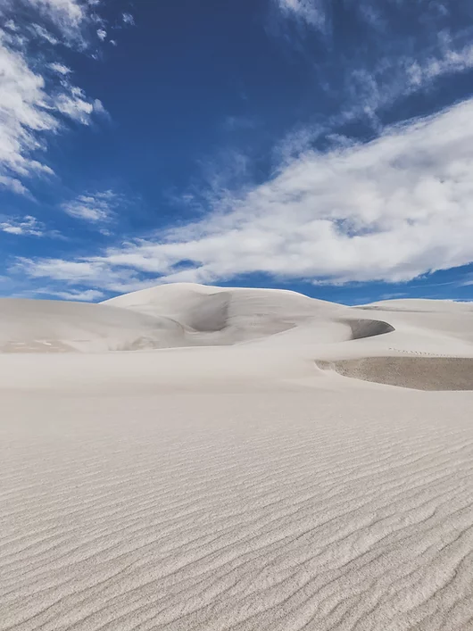
After Hualfin, the road will start to climb to reach the Desert Plateau called Puna. Between groups of vicuñas, giant white sand dunes, volcanos and lagoons, we will reach the Oasis of El Peñón, our starting point for tomorrow’s excursions.
El Peñón is a small village at 3.400 meters, where 200 people, mostly shepherds live and work. It is one of the last authentic Puna villages, with water and green grass (Vega) that allows the grazing of llamas, goats and sheep. Night at Hosteria de Altura de El Peñón.
Quebrada de las conchas, beautiful and colorful mountains
El Porvenir, Cafayate
Ruinas de quilmes, ancient citification ruins and museum
El Peñón | Volcán & Laguna Carachi Pampa | Campo de Piedra Pómez | Dunas Blancas | El Peñón
Estimated driving time: 7 hs. | Distance: 130 km of earth, gravel and salt tracks. | Altitude : Highest point 4.200 m./ 13.780 f. El Peñón 3.400 m. / 11.155 f. | Meals Included: breakfast, lunch and dinner.
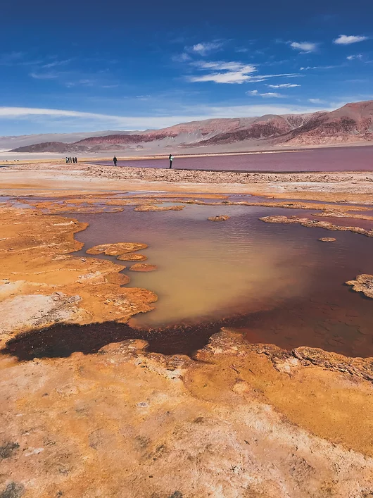
Our adventure starts today at the edge of Campo de Piedra Pómez, as we reach the Carachi Pampa basin, in its margins there is a Volcano of the same name, surrounded by black lava fields and a lagoon, where the Andean flamingo, and the James’ (or puna) flamingo can be found. During the dry season a small salt lake is formed around the lagoon. Later, our journey will continue into the Natural Reserve Campo de Piedra Pómez, a strange and stunning landscape carved into the rock that gives rise to its name: The Pumice.
Of purely igneous origin, it was produced from a massive explosion of the volcanic stratum, this explosion was so powerful that if one could have seen it, it would be similar to the mushroom cloud produced by a nuclear bomb. This cloud has spread the ashes and debris in large areas and in different directions, which crystallized by the effects of the temperature giving shape to these wonderful rocks with special features and with plenty of holes produced by the escape of gasses during the chilling stage. This degassing phenomenon made the rock very easy to carve by the winds of the Puna, arid and harsh winds that move freely through the region, becoming the best and most prominent Andean rock sculptors.
This strange landscape of white labyrinths and climbing sand dunes is located a few miles to the west, on a track where the path continues through some sand that we could describe as the dream of the explorer, an overlanding adventure. Return to the Hotel, just on time to enjoy stunning sunset views from the village.
El Peñón | Antofagasta de la Sierra | Quebrada de Calalaste | Vega Colorada | Oasis Antofalla & Antofallita | Cono de Arita | Tolar Grande
Estimated driving time: 7 hs. | Distance : 340 km / 211 ml earth track and salt road. | Altitude : Highest point 4.500 m./ 14.764 f. Tolar Grande 3.500 m. / 11.483 f. | Meals Included: Breakfast, lunch and dinner.
Antofagasta de la Sierra was the biggest Oasis on the path connecting this side of the Andes with the Oasis of San Pedro de Atacama (Chile). It is a big village with more than 2.000 people who maintain their ancient traditions and culture. The name Antofagasta means “place where the sun shines’ ‘ and it is surrounded by uncountable Volcanic Peaks. The valley of Calalaste, just a few kilometers away from Vega Colorada is the best spot to find wild camelids. Above 4.200 meters with wide views over the Antofalla Volcano (6.400 mts) lays a green field (Vega Colorada) home to llamas, suris (Andean ostrich), wild donkeys and vicuñas. Antofalla, together with Antofagasta and Santa Rosa, were important stations for llama caravans connecting this part of the Andes with the Oasis of Atacama.
The Oasis is located just at the border of the longest salt flat in the world, among red mountains and lava strips. Antofalla is still inhabited by a tiny community of 60 people who are all shepherds. The crossing of the Arizaro salted dry lake resembles the ancient journey of the Arrieros (shepherds guiding caravans of animals to Chile). Arizaro meaning Vultures Cemetery comes from a period when many animals (cows and horses) perished during the crossing of the salt flat.Tolar Grande lies at the border of a giant depression, the Salar de Arizaro, one of the biggest salt flats in the world. From this tiny old railway village built in 1940, there is a unique view over the western ridge of the Cordillera, an infinite skyline of Volcanoes higher than 6.000 meters.
Tolar Grande| Ojos del Mar | Desierto del Laberinto | Santa Rosa de los Pastos Grandes | San Antonio de los Cobres
Estimated driving time: 5 hs. | Distance: 140 km / 87 ml earth track. | Altitude: Highest point 4.000 m./ 13.123 f. San Antonio de los Cobres 3.700 m. / 12.140 f. | Meals Included: Breakfast, lunch and dinner.
The morning will be dedicated to the exploration of the surroundings of Tolar Grande. The Ojos del Mar are Blue Holes in the middle of a white salt lake, where in Feb. 2009, researchers discovered a huge colony of living stromatolites. The surroundings of Tolar Grande offer chances of great small hikes, the best one is the hike to a hidden sand dune in the middle of the desert. From the highness of the dune the traveler will be rewarded by a 360° view over the area, from the Sacred Macon Mountain to the Llullaillaco Volcano, where the National Geographic discovered in 1999 at 6.735 meters an Inca treasure including the body of 3 Inca children perfectly kept by ice and dryness. It is also a perfect place for meditation.
The Labyrinth Desert is a 10 million–year fossil dune desert formed by clay picks and gypsum crystals. Nowadays it is possible to drive across this natural wonder, a must for photo safari lovers. Abra Chorrillos will be our highest point and there we will learn about the Apacheta and its cultural importance for the Andean tradition. San Antonio de los Cobres is the actual Capital of the Puna, a dusty village with a colored community, our last point of civilization and the arrival point of most tourists.
Note: Since we operate many of our tours in remote high altitude areas itineraries may be subject to change due to weather and road conditions or any other conditions of an operational nature throughout the year (such as: snow fall, heavy rain, strong winds, etc.), especially in places higher than 4000 meters. As such we reserve the right to alter, and/or cancel any section and/or parts of the itinerary which may result from conditions beyond our control.
San Antonio de los Cobres | Sey | Susques |Salinas Grandes | Purmamarca
Estimated driving time: 6 hs. | Distance: 140 km / 87 ml paved road. 120 km / 74 ml earth track and gravel road | Altitude: Highest point 4.500 m./ 14.764 f. Purmamarca 2.192 m. / 7.192 f. | Meals Included: Breakfast and lunch.
San Antonio de los Cobres is the actual Capital of the Puna, a dusty village with a colored community, our last point of civilization and the arrival point of most tourists.
El Mojon, a small settlement lost in this high desert, is an extraordinary example of the strength of the people inhabiting the Puna and how they can live in the XXI century without forgetting their ancestral traditions.
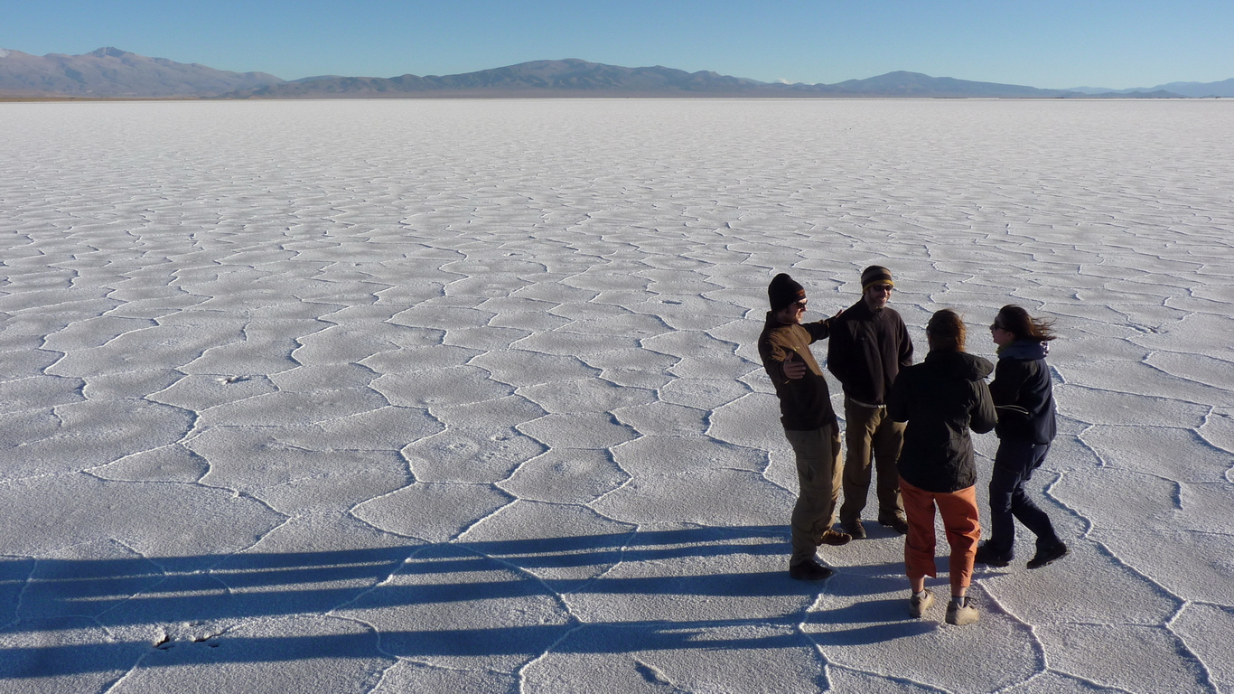
Salinas Grandes is a place with more than 100km of salt surrounded by volcanoes, where the horizon seems endless. Finally, crossing the highest point of the itinerary, we will enjoy the best view on the Eastern Cordillera of the Andes going down the Cuesta de Lipan. At sunset, we will arrive at the andean village of Purmamarca, built in the surrounding area of the Cerro de los 7 Colores.
Estimated driving time: 6 hs. | Distance: 320 km / 199 ml paved road. 70 km / 43 ml gravel road | Altitude: Highest point 4.300 m./ 14.108 f. Salta 1.200 m. / 3.937 f. | Meals Included: Breakfast and lunch.
The Humahuaca Gorge is a large valley that ends at the border with Bolivia and it is located in the province of Jujuy in the far north of Argentina. It is quite a young Valley, given that its formation dates a million years.
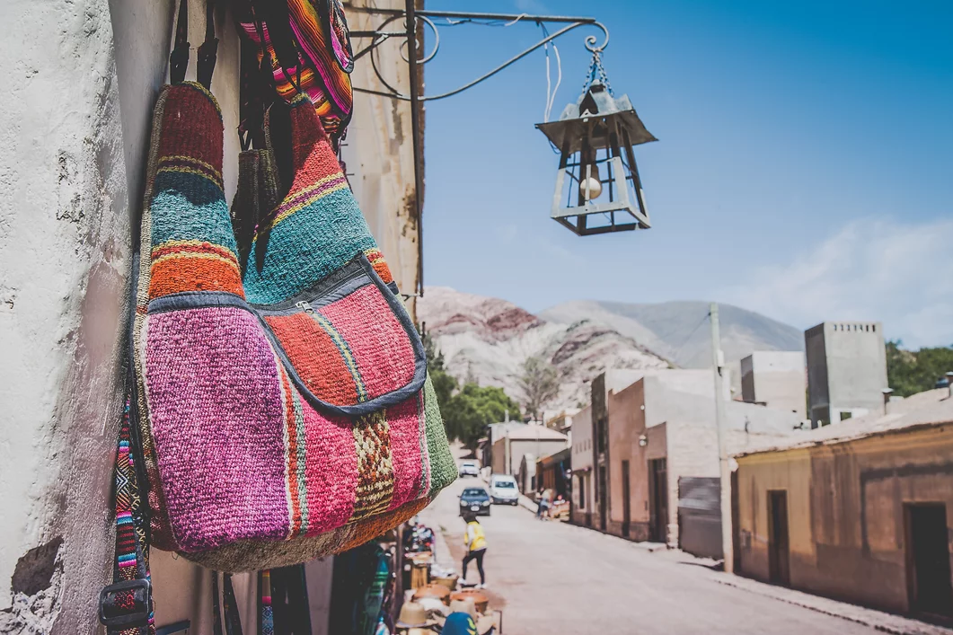
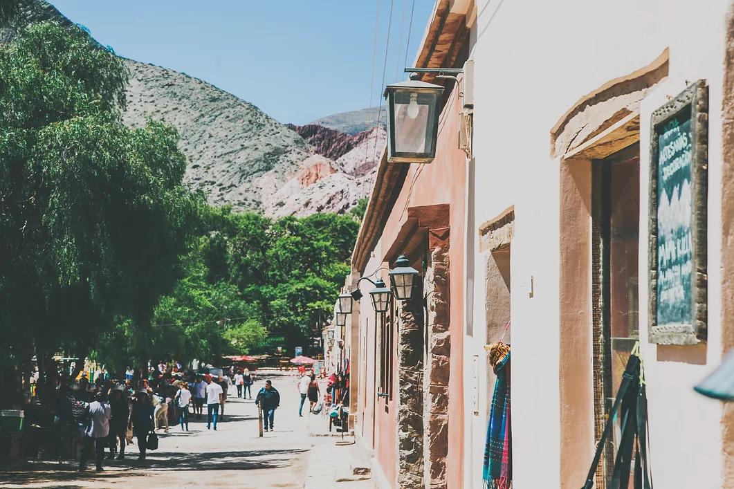
The Gorge is famous for its colorful mountains, its geological formations and its historical villages. During our trip we will visit the best places in the region in order to get a true feeling of this part of Argentina: the Humahuaca Market, a walk in the Colorado’s Gorge, the sacred garden of the Cardones (cactus species) at 3200 meters, and the impressive 14 coloured mountains of Hornocal and the Pucara of Tilcara – a pre-Inca fortress. We will also visit the villages of Tilcara, Humahuaca and Purmamarca with their typical artisanal markets. In the afternoon we will return to Salta.
End of our services.
The Itinerary is subject to weather conditions in the region to be visited, to flight schedule changes, road blocks or any other unforeseen circumstances. In any of these cases last minute changes may take place in order to ensure a safe trip. Any expenses derived of these situations of force majeure must be paid by the passenger.