Esplorate le gemme nascoste della Cordigliera delle Ande.
Avventura nel deserto di El Peñón
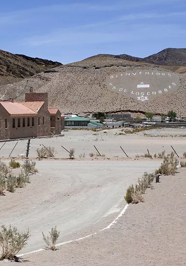
Il piccolo villaggio di El Peñón si trova nella provincia di Catamarca, nel cuore dell'incredibile bellezza della Puna argentina (deserto andino di alta quota). È la base perfetta per esplorare meraviglie come la Laguna Grande, dove migliaia di fenicotteri si incontrano in un ambiente spettacolare, e le imponenti dune. La vasta Riserva Naturale Campo di Pietra Pomice (Campo de Piedra Pomez), l'Oasi di Antofalla abitata da 60 persone lungo una delle più importanti Saline del Sud America. Il villaggio è anche situato in una posizione strategica per effettuare spedizioni al remoto Vulcano Galán e alle splendide regioni del Vulcano e del Lago Peinado, tra le altre gemme nascoste della Cordigliera Andina.
"Il nostro destino non è mai un luogo, ma un nuovo modo di vedere le cose"
Henry Miller
Cosa faremo
esperienza in questo viaggio,
giorno per giorno
Cosa comprende il viaggio?
Testimonianze
Ritornati da un viaggio nella punga argentina ....tutto meraviglioso anche grazie allo staff Socompa!!! Agenzia consigliatissima!!! Alla prox....
René Jordan
Testimonianze
WOW! Abbiamo fatto un viaggio davvero fantastico con Socompa nella regione argentina della PUNA.
Johan
Testimonianze
Viaggio fantastico ed emozionante! ¡Ocho días inmersos en la naturaleza con paisajes maravillos!
Mónica
Inviateci un'e-mail a info@socompa.com oppure compilate il modulo
Entrare a far parte della Tribù Socompa
El Peñón Desert Adventure / Day 1
Salta | Quebrada de las Conchas | Cafayate | Santa Maria | Hualfín | El Peñón
Estimated handling time: 7 hours. | Distance: 440 km of asphalt. 50 km of gravel road. | Altitude: Maximum 4,100 m. Altitude in El Peñón 3,400 m. | Meals Included: Lunch.
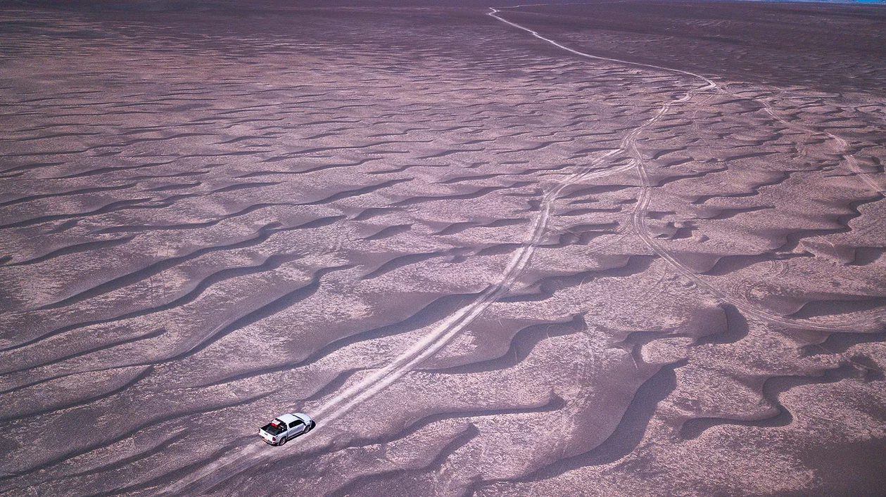
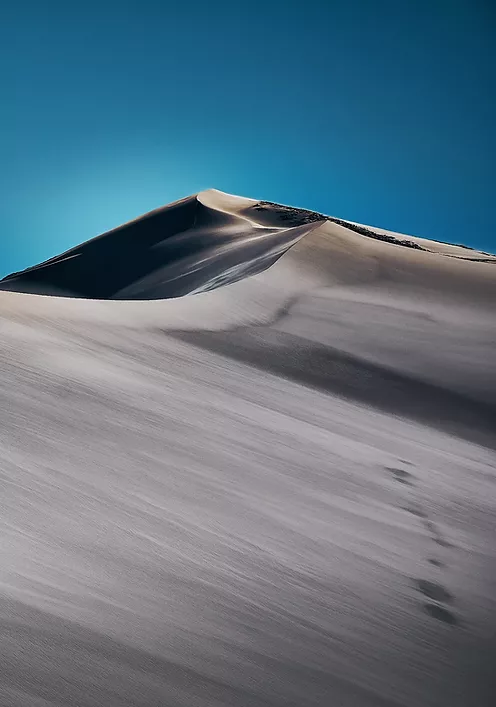
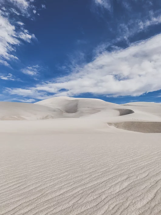
Per iniziare la giornata, attraverseremo il maestosa La Quebrada de las Conchas, dichiarata patrimonio naturale dell'Umanità, è un canyon di 65 km di formazioni rocciose sedimentarie dell'era mesozoica e cenozoica (90-60 milioni di anni). Il caratteristico colore rosso deriva dalla presenza di ossido ferrico nei suoi depositi minerali. Il nome "delle Conchiglie" (de las Conchas) deriva dall'abbondante quantità di colonie fossili di conchiglie, pesci e molluschi, testimonianza del clima tropicale umido che dominava la zona in tempi remoti. Poi viaggeremo attraverso gli altopiani desertici della Puna, un percorso di 150 km che sale tra paesaggi imponenti nella terra dei vulcani più alti del mondo. All'altezza del passo di montagna più alto del percorso, troveremo un'immensa duna di sabbia. Dopo di che, arriveremo alla piccola oasi di "El Peñón", dove passeremo la notte. Pernottamento presso la Hostería de Altura El Peñón.
El Peñón | Volcán e Laguna Carachi Pampa | Campo di Piedra Pómez | Dunas Blancas | El Peñón
Estimated handling time: 7 hours. | Distance: 130 km / 80 ml of earth, gravel and salt tracks. | Altitude: Highest point 4.200 m./ 13.780 f. El Peñón 3.400 m. 11.155 f. | Meals Included: Breakfast , lunch and diner.
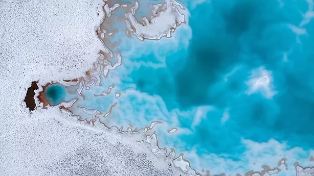
Our adventure begins today at the edge of the Campo de Piedra Pómez. Upon reaching the Carachi Pampa basin, we will see that the homonymous volcano is located on its margins, surrounded by black lava fields and a lagoon, where the Andean flamingo and the James (or puna) flamingo can be found. During the dry season a small salt lake forms around the lagoon. Later, our trip will continue towards the Campo de Piedra Pómez Nature Reserve, a strange and impressive landscape that emerged from the erosion of the rock that gives it its name: Pómez.
Of purely igneous origin, it was produced from a massive explosion of the volcanic stratum. This explosion was so powerful that if it could have been seen, it would have been similar to the mushroom cloud produced by a nuclear bomb. This cloud has spread the ash and debris over large areas and in different directions. These crystallized due to the effect of temperature, giving shape to these wonderful rocks with special characteristics and with abundant holes produced by the escape of gases during the cooling stage. This degassing phenomenon made the rock very easy to carve by the Puna winds, arid and harsh winds that move freely through the region, becoming the best and most prominent Andean rock sculptors. This strange landscape of white labyrinths and climbing dunes is found a few kilometers to the west, on a track along which the path continues through some sandbanks that could be described as an explorer’s dream…an overlanding adventure. We will return to the hotel, just in time to enjoy the impressive views of the sunset from the town. Night at the Hostería de Altura El Peñón.
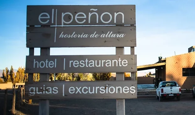
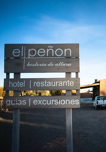
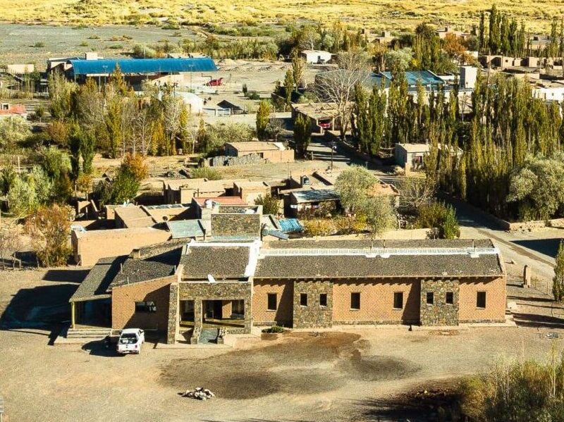
Hosteria El Peñon
El Peñon
Peñon
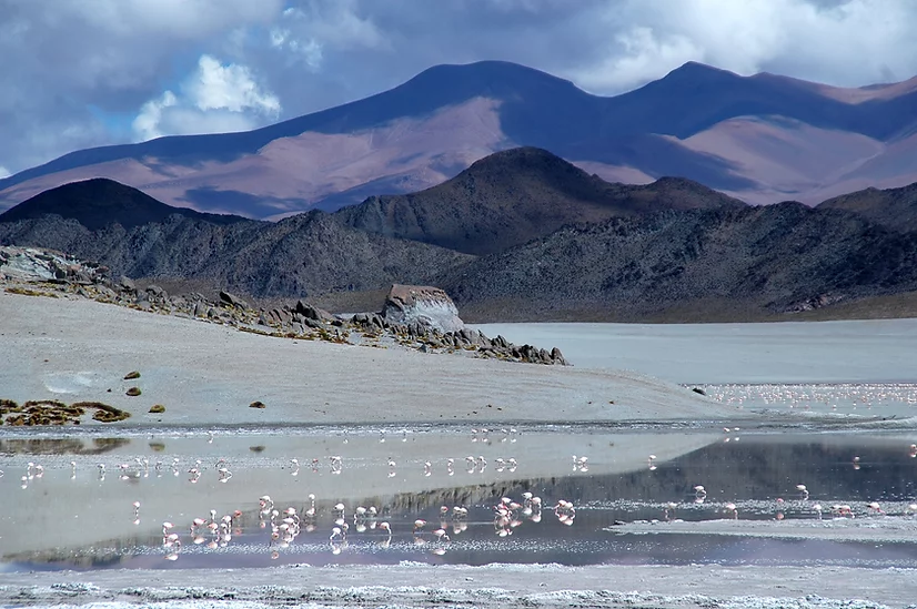
Laguna Carachi pampa el penon
Vista sulla pietra pomice del vulcano Carachi Pampa
Estimated handling time: 8 hours. | Distance: 120 km / 74 ml dirt path and gravel road, 60 km / 37 ml paved road (EL Peñón-Antofagasta) | Altitude: Highest point 5.000 m./ 16.404 f. El Peñón 3.400 m. / 11.155 f. | Meals Included: Breakfast , lunch and diner.
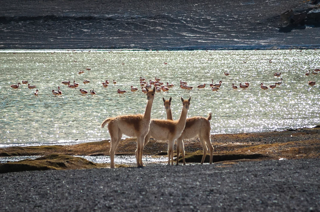
With an early start, we will drive in direction to Antofagasta de la Sierra as we enter the región of Real Grande (4050 meters), where traces of the first settlements of the Puna can be found in ancient petroglyphs dated to the year 10000 B.P. This point is also the entrance to the Cerro Galán Caldera from the Northwest. Cerro Galán is the largest volcanic caldera in the Andes Mountains and one of the largest in the world. Its dimensions are 34 km from north to south and 24 km from east to west, and it is the result of an extreme plinian eruption that occurred 2.2 million years ago. Its identification as a volcanic caldera was made using satellite photographs, since its elliptical shape is too large to be appreciated from the ground. Its walls reach 5,000 meters of altitude and the central peak 5,912 meters, while its floor is at 4,500 meters of altitude. At its southwestern ende, the Caldera contains a lake known as Laguna Diamante, which is home to flamingos and ducks, which are protected from the wind and this extremely harsh environment, by the walls of the caldera. Our path will lead us to another high altitude Andean lake known as Laguna Grande Reserve, a saline lake located at an altitude of 4150 meters. During winter, the water freezes completely, but when spring arrives, it becomes the largest gathering center of the Puna flamingo birds, also called Small Parina (Phoenicopterus jamesi), with more than 19,000 birds (25% of the known total population). In summer, it is also a meeting place for the Andean flamingo (Phoenicopterus andinus) and it is a common nesting site of Southern flamenco (Phoenicopterus chilensis). We will drive back to El Peñón with the perfect warm light of sunset. Night at the Hostería de Altura El Peñón.
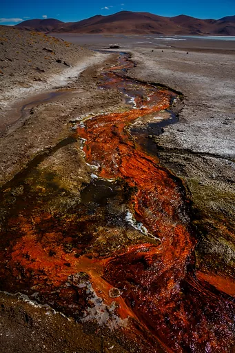
El Peñón | Quebrada de Calalaste | Oasis de Antofalla | Ojos del Campo | El Peñón
Estimated handling time: 7 hours. | Distance: 130 km / 80 ml of earth, gravel and salt tracks. | Altitude: Highest point 4.200 m./ 13.780 feet. El Peñón 3.400 m. / 11.155 feet. | Meals Included: Breakfast, lunch and diner.
Antofalla derives from the native language Kunza and means town where the sun dies. Getting there from El Peñón involves climbing mountains to the Abra de los Colorados at 4,667 masl along a road that was only inaugurated in 1989. The largest Oasis in the Puna, the Salar de Antofalla, is the longest salar in the world, its width never exceeds 12 kilometers. The extreme southeast of the Salar de Antofalla is a hyper-arid place with extraordinary tertiary salt formations that can be reached from Antofagasta de la Sierra or from Salta territory following the Arizaro salt flat to the south. It is one of the most inhospitable and inaccessible places in the Argentine Puna. The salt flat nestled between the Sierras de Antofalla and Calalaste (the latter has an infinite number of unique colors), has an average altitude of 4,210 meters, with the maximum being 6,227 and the minimum being 3,270. Within this there is a formation of lagoons called “Ojos de Campo”, among them there is one that contains reddish waters. There is also a hot spring area that includes the isolated Botijuelas hot springs. The local community is open to tourism and offers home cooked lunches and homestay accommodation to experience life in one of the most remote corners of the world. We will drive back to El Peñón with the stunning sunset colors of the andean mountains. Night at the Hostería de Altura El Peñón.
El Peñón | Hualfin | Santa Maria | Cafayate | Quebrada de las Conchas | Salta
Estimated driving time: 4 hs. | Distance: 122 km / 196 ml of paved road. 81 km / 130 ml of dirt and gravel road. | Altitude: Highest point 3.457 m. / 11.338 f. Molinos 2.020 m. / 6.625 f. | Meals Included: Breakfast and lunch.
After days of intense travel on the High Desert Plateau, the North West still has plenty of surprises. The paved road from El Peñón to meet Route 40 is a 150 km long yellow field of Paja Brava, white lagoons and a deserted narrow canyon filled with rich vegetation.
Then, we will do a quick stop in Cafayate, a pleasant town surrounded by green vineyards. In the afternoon with the best light of the day we’ll go across the Quebrada de las Conchas Gorge, 55 km of scenic sedimentary rock formations, dated from forty to a hundred million years old, with geological formations such as the Yacoraite or the Pirguas which are of great importance. Salta and its green valley will welcome us after five days of unique adventure.
Protezione solare e occhiali da sole (protezione dai raggi UV) Tutto l'anno!
Cappello. Tutto l'anno!
In inverno guanti (di lana o materiale simile).
In autunno/inverno (da maggio ad agosto), l'abbigliamento deve essere rinforzato: giacca invernale, felpe, camicia in pile a maniche lunghe, sciarpa, ecc.)
Giacca a vento (è importante perché nella zona c'è vento). solo in inverno
Giacca impermeabile durante l'estate (da metà dicembre a metà marzo)
Estimated handling time: 8 hours. | Distance: 150 km / 93 ml dirt and gravel road. | Altitude: Highest point 4.750 m./ 15.584 f. El Peñón 3.400 m. / 11.155 f. | Meals Included: Breakfast , lunch and diner.
Our path will lead us first to a high altitude Andean lake known as Laguna Grande Reserve, a saline lake located at an altitude of 4150 meters. During winter, the water freezes completely, but when spring arrives, it becomes the largest gathering center of the Puna flamingo birds, also called Small Parina (Phoenicopterus jamesi), with more than 19,000 birds (25% of the known total population). In summer, it is also a meeting place for the Andean flamingo (Phoenicopterus andinus) and it is a common nesting site of Southern flamenco (Phoenicopterus chilensis). Cerro Galán is the largest volcanic caldera in the Andes Mountains and one of the largest in the world. Its dimensions are 34 km from north to south and 24 km from east to west, and it is the result of an extreme plinian eruption that occurred 2.2 million years ago. Its identification as a volcanic caldera was made using satellite photographs, since its elliptical shape is too large to be appreciated from the ground. Its walls reach 5,000 meters of altitude and the central peak 5,912 meters, while its floor is at 4,500 meters of altitude. At its southwestern ende, the Caldera contains a lake known as Laguna Diamante, which is home to flamingos and ducks, which are protected from the wind and this extremely harsh environment, by the walls of the caldera. We will drive back to El Peñón with the perfect warm light of sunset. Night at the Hostería de Altura El Peñón.