The Argentine Northwest boasts some of the world’s most stunning natural environments, from sacred Andean mountains to the lush Yungas jungle and the vast high desert known as the Puna. These lands, still home to indigenous communities preserving their traditions, offer a deep connection to the transcendental. The diverse landscapes reflect the variety of people who inhabit these remote areas, including shepherds, artisans, and workers who keep ancestral wisdom alive. For over 16 years, we’ve crafted unforgettable adventures across the Calchaquíes Valleys and Quebrada de Humahuaca, ensuring each journey is filled with safety, quality, and lasting memories.
Five minutes is enough to dream a lifetime. that’s how relative time is.
Mario Benedetti
What to discover
in a day of adventure
in the northern Argentina?
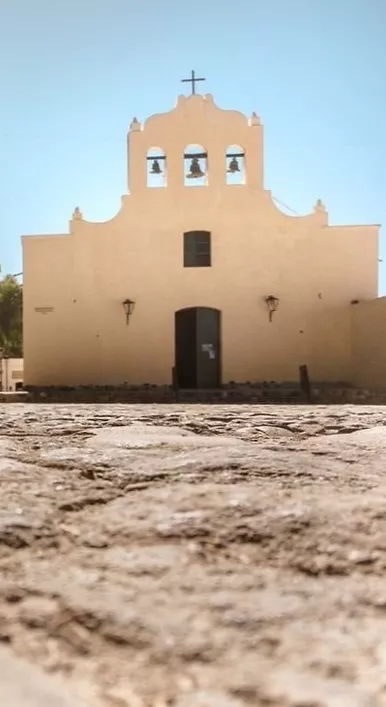
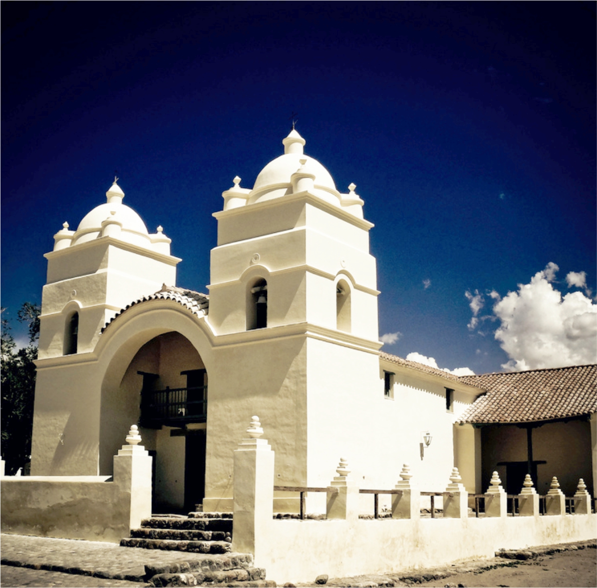
Cachi & Los Cardones National Park
This trip covers the road between Salta and Cachi, one of the most spectacular in the North of Argentina
If you have a few days to visit the North of Argentina, our recommendation is to take trips with at least one night in one of the magical Andean towns or the Calchaquí Valleys.
Below we share the adventures available, which can also be customized.
Adventure is in our DNA and it means making you live unique, transformative and immersive experiences. Get you to disconnect from your day to day and connect with your essence, nature, culture, history, flavors ... Take yourself out of your comfort zone for a little while, but with comfort and without worries.
The change of scenery also helps you discover and consider new ideas that you had not thought of before. You will return home with different notions and possibilities. Socompa ...
Experiences that transform.
Every adventure always begins in the thought
The true trip is the one that is dreamed, planned, prepared, the one that is lived first in that longing to know a destination. If you are going to come to the North there is nothing more beautiful than to start with a good reading and a great map. Then you will live a unique, unforgettable experience that you will relive again by telling a story.
¿What does the journey include?
Testimonios
"Buby has very good knowlegde of history, geology, ornithology. Also very entusiastic about
every aspect of the journey and good at spotting bird life. Our expectations of the andes
were completely exceeded!"
Michael & Rachel (UK).
Testimonios
"Above excellent! Couldn't have asked for a better guide. We had a wonderful trip thank you
so much!"
Linda & Sunil (USA)
Testimonios
"It was a very good experience and we got to see all the attractions that we had expected to
see. Our guide was very knowledgeable and showed us a lot of sites which we were not
aware. It was a wonderful experience"
Ruchir & Aditi (India)
Please send us an e-mail to info@socompa.com or fill the form
Join the Socompa Tribe
Cachi & Los Cardones National Park
Distance: 260 km / 161 ml of paved road, 70 km / 43 ml of gravel road | Altitude: Highest point 3,457 m. / 11,342 f. Cachi 2,280 m. / 7,480 f. Salta 1,200 m. / 3,937 f. | Estimated driving time: 6 hours. | Departure time: 8:30 am. | Estimated return time: 7:00 pm.
This trip covers the road between Salta and Cachi, one of the most spectacular in the North of Argentina.
We will pass through four different ecosystems, from the green jungle of the Yungas to the Calchaquíes Valleys and semi-deserts.
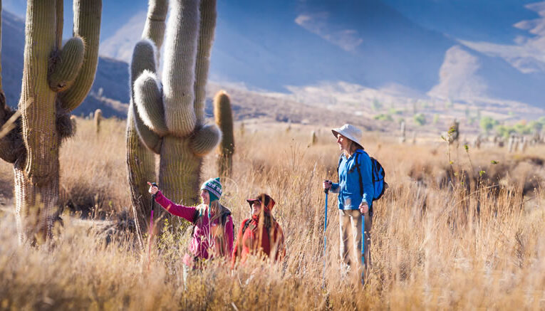
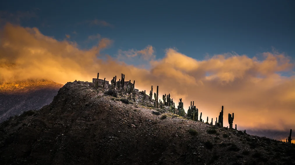
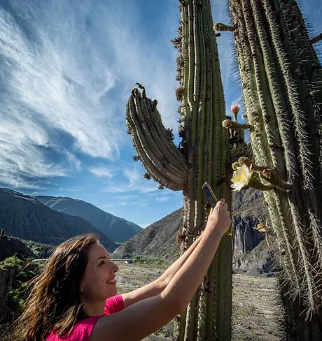
We will travel 33 km of mountain that will bring us to Paso Piedra del Molino at 3457 meters. The postcard will be incredible with condors flying in the blue sky, guanacos and wild donkeys among thousands of cardones, the local species of giant cactus, scattered across a field at the foot of the impressive Nevado de Cachi (6400 meters).
We will have time for a hike in a little visited red desert and a moment of relaxation under the shade of a cozy Molle in the colonial town of Cachi, where the sun shines almost all year round without interruption. In the afternoon we return to Salta.
Distance: 380 km / 236 ml paved road. | Altitude: Highest point 1,850 m. / 6,070 f. Cafayate 1,683 m. / 5,521 f. Salta 1,200 m. / 3937 f. | Estimated driving time: 6 hs. | Departure time: 8:30 am. Estimated time of return: 7:00 pm.
The exquisite combination of climate, soil, vines, human experience and especially the altitude, make the Calchaquí Valleys an oasis for vine production, generating excellent high-end wines.
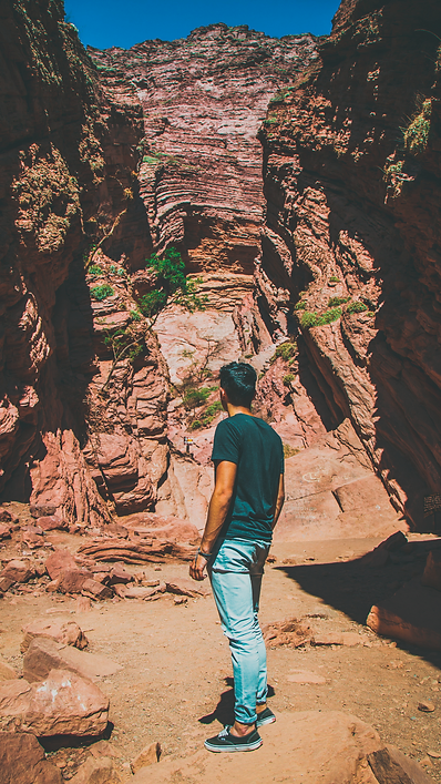
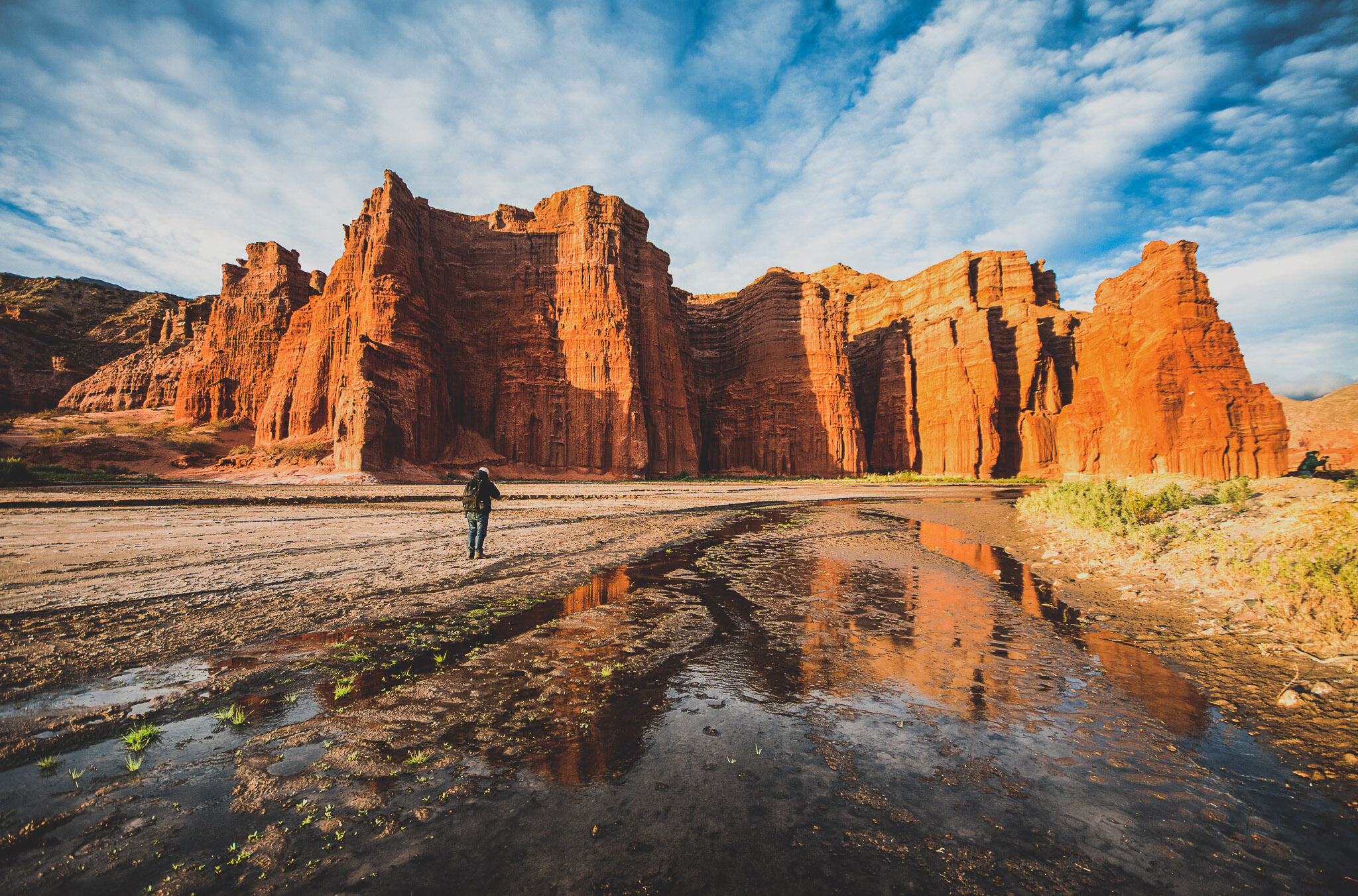
On this trip we will also explore the Quebrada de las Conchas, 70 km of a deep canyon formed in the last 50 million years with huge deposits of minerals (clay and sandstone in particular), shaped by water and wind. This formation comes from a time when the region was dominated by a humid and warm climate, creating a large lake form in which today we can only find the mineral remains in the colorful mountains.
During the trip we will visit a winery in Cafayate. Return to Salta at sunset, it will be a great opportunity to take amazing pictures of the Quebrada.
Quebrada de las conchas, beautiful and colorful mountains
Distance: 380 km / 236 ml paved road. | Altitude: Highest point 1,850 m. / 6,070 f. Cafayate 1,683 m. / 5,521 f. Salta 1,200 m. / 3937 f. | Estimated driving time: 6 hs. | Departure time: 8:30 am. Estimated time of return: 7:00 pm.
We meet our guide at the agreed time at the door of the Cathedral.
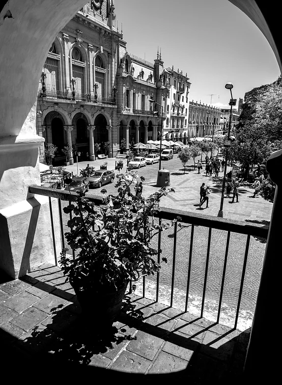
We will visit the historical buildings of Salta City: San Bernardo Convent, San Francisco Church and then the main square.
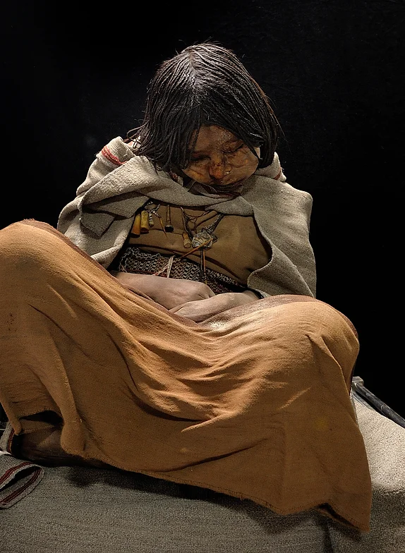
Later, we will explore the MAAM (Museum of High Mountain Archaeology) to learn more about the High Mountain Sanctuaries of the Andes, the Inca footprint in Salta and the Pre-Columbian History of South America, under a unique approach based on the discovery, made by National Geographic, of an Inca Sanctuary at the top of the Llullaillaco Volcano in the Andes Mountains. We will also visit some of the city’s most authentic markets and stores.
The tour includes: – Entrance fee to the MAAM Museum (Museum of High Mountain Archaeology). Specialized guide.
Notes: 1. The museums are closed on Mondays, except when it is a holiday, then it will be open and close the following Tuesday. We will propose alternative visits if the Museum is closed.
Distance: 520 km / 836 ml of paved road. | Altitude: Highest point 2,936 m. / 9,630 f. Salta 1,200 m. / 3936 f. | Departure time: 8:00 am. | Estimated time of return: 7:00 pm.
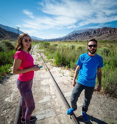
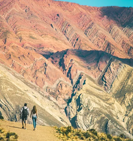
The Quebrada de Humahuaca is a long valley that ends almost at the border with Bolivia. It is located northwest of the Province of Jujuy and is the most Andean territory of Argentina.
It is a fairly young valley (its formation dates back to a million years ago), where huge cuts of the tectonic plates, pushed by the rise of the Andes, worked on major sedimentary deposits to create the actual appearance of the Quebrada. Here, layers from different geological periods are set upside down or simply vertical.
It is famous for its colorful mountains, its geological formations and its historical towns.
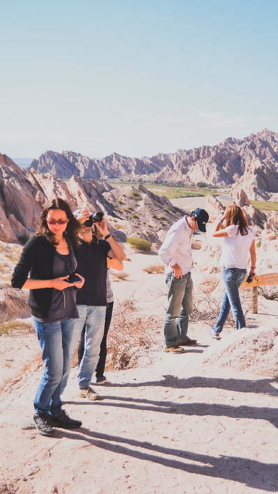
During our trip we will feel and live the real atmosphere of this Andean corner of Argentina: the local food market of Humahuaca, the Quebrada de las Señoritas, the sacred garden of Cardones near Humahuaca and the Pucará de Tilcara, among other amazing places that represent the pre-Hispanic culture and history of the region.
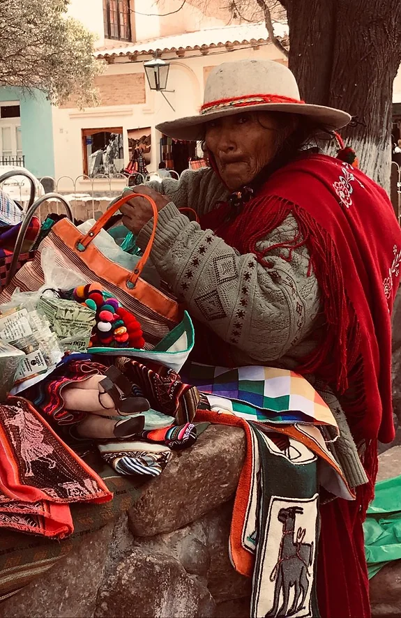
Before returning to Salta, we will enjoy some time visiting the colorful handicraft markets of the Quebrada.
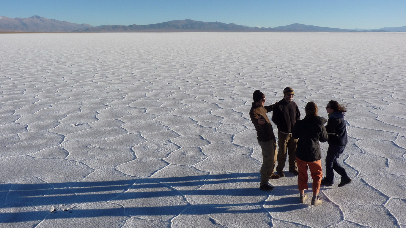
SALTA | QUEBRADA DEL TORO | SAN ANTONIO DE LOS COBRES | SALINAS GRANDES | PURMAMARCA | SALTA
Distance: 322 km / 518 ml paved road. 183 km / 294 ml gravel road. | Altitude: Highest point 4,170 m. / 13,677 f. Salta 1,200 m. / 3,936 f. | Estimated driving time: 8 hs. | Departure time: 8:00 am. Estimated time of return: 7:00 pm.
The Quebrada del Toro is a natural elevator that connects the green valley of Salta (Valle de Lerma), rich in tobacco and horse breeding, with an arid plateau located above 3500 meters, called Puna.
In this trip through Northern Argentina, in less than 100 km, following a route that runs along the old railway known as the Train to the Clouds, we will cross the eastern chain of the Andes to enter the Puna.
El Mojón, a small settlement lost in this high desert, is an extraordinary example of the strength of the inhabitants of the Puna and how they can live in the 21st century without forgetting their ancestral traditions.
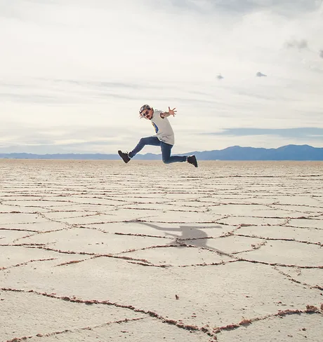
Salinas Grandes is an open white space of more than 100 km, surrounded by volcanoes, where the horizon seems to have no end. Finally, crossing the highest point, we will enjoy the best views of the Eastern Andes Mountain Range going down the Cuesta de Lipán.
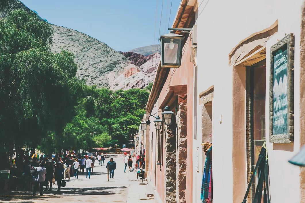
We will arrive at the Andean village of Purmamarca, built in the surroundings of the hill of the 7 Colors, where we will have time to visit the square and the handicraft market before returning to Salta.
SALTA | PURMAMARCA | SALINAS GRANDES | SALINAS GRANDES | PURMAMARCA | SALTA
Distance: 480 km / 772 ml paved road. | Altitude: highest point 4,170 m. / 13,681 f. Purmamarca 2,192 m. / 7,192 f. Salta 1,200 m. / 3,937 f. | Estimated driving time: 7 hours. | Departure time: 8:00 am. Estimated return time: 7:00 pm.
The Quebrada de Humahuaca is a large valley, located in the province of Jujuy, in the extreme north of Argentina, which flows into the border with Bolivia.
It is a fairly young valley, since its formation dates back to a million years ago. The Quebrada is famous for its colorful mountains, its geological formations and its historic villages.
We will visit the town of Purmamarca and Los Colorados, a road of red, green and brown colors, hidden behind the hill of the seven colors.
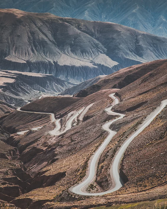
Then we take route 52, which connects Argentina with Chile to climb the Lipán slope (4170 meters above sea level), this is the break point between the Eastern Andes and the Western Cordillera, in the middle of the altitude plateau called the Puna.
In this gigantic depression we will find Salinas Grandes, a white salt mirror in an extension of 100 km. This salt flat is surrounded by volcanoes, where the horizon seems infinite. After a rest we will return to Purmamarca to visit the Plaza and the handicraft market before returning to Salta.
Day 1: SALTA | QUEBRADA DEL TORO | SAN ANTONIO DE LOS COBRES | SALINAS GRANDES | PURMAMARCA
Distance: 142 km / 228 ml of paved road. 179 km / 288 ml of gravel road. | Altitude: Highest point 4.170 m. / 13,677 f. Purmamarca 2,192 m. / 7,189 f. | Estimated driving time: 6 hs.
The Quebrada del Toro is a natural elevator that connects the green valley of Salta (Valle de Lerma), rich in tobacco and horses, with an arid plateau at more than 3500 meters, called Puna. In less than 100 km, by the old railroad known as the Tren a las Nubes (Train to the Clouds), we will cross the eastern chain of the Andes to enter the Puna.
El Mojon, a small settlement lost in this high desert, is an extraordinary example of the strength of the inhabitants of the Puna and how they can live in the 21st century without forgetting their ancestral traditions. Salinas Grandes, is an open white space of more than 100 km, surrounded by volcanoes, where the horizon seems to have no end.
Finally, crossing the highest point, we will enjoy the best views of the Eastern Andes Mountain Range going down the Cuesta de Lipán. At sunset, we arrive at the town of Purmamarca, built in the surroundings of the Cerro de los 7 Colores. Day 2: PURMAMARCA | HUMAHUACA | HORNOCAL | TILCARA | SALTA Distance: 320 km of paved road. Gravel road of 70 km. Altitude: Highest point 4.300 m. Salta 1,200 m. Estimated driving time: 6 hs.
The Quebrada de Humahuaca is a large valley that flows into the border with Bolivia. It is located in the province of Jujuy in the extreme north of Argentina. It is a fairly young valley, since its formation is only one million years old. La Garganta is famous for its colorful mountains, its geological formations and its historic villages. During our visit we will reach the best place to feel the real atmosphere of this part of Argentina: the Humahuaca Market, a walk through the Colorado Gorge, a sacred garden of Cardones at 3200 meters, the impressive Serranía de Hornocal and the Pucará de Tilcara (a pre-Inca fortress). We will also visit the towns of Tilcara, Humahuaca and Purmamarca with their typical handicraft markets. In the afternoon return to Salta.
Day 1: SALTA | CUESTA DEL OBISPO | CACHI | MOLINOS
Distance: 122 km / 196 ml of paved road. 81 km / 130 ml of dirt and gravel road. | Altitude: Highest point 3.457 m. / 11.338 f. Molinos 2.020 m. / 6.625 f. | Estimated driving time: 4 hs.
The road between Salta and Molinos is one of the most spectacular roads in Northern Argentina. We will pass through four different ecosystems, from the green jungle of the Yungas to the Calchaquíes Valleys and semi-deserts. We will travel 33 km of mountain that will take us to Paso Piedra del Molino at 3457 meters, with condors flying in the blue sky, guanacos and wild donkeys among thousands of cardones, the local species of giant cactus. There will be time for a walk through a little-visited red desert and a moment of relaxation under a cozy Molle tree in the colonial town of Cachi, where the sun shines almost all year round. Overnight in the small village of Molinos in an isolated valley with a rich history (accommodation not included).
Day 2: MOLINOS | ANGASTACO | QUEBRADA DE LAS FLECHAS | CAFAYATE | QUEBRADA DE LAS CONCHAS | SALTA
Distance: 200 km of paved road. Gravel road 130 km. Altitude: Highest point 2.300 m. Salta 1,200 m. Estimated driving time: 6 hs.
Route 40 is one of the most famous and longest routes in the world. Between the towns of Molinos and Cafayate we will find many small villages, inhabited by local winemakers and farmers. We will cross the Quebrada de las Flechas, a desert formed by lime stone dust and quartz, eroded by wind and water creating the shape of thousands of arrowheads.
Cafayate is the perfect place to have lunch or visit a traditional winery. On the way back to Salta, we will explore the Quebrada de las Conchas at the best time of the day. The canyon features 70 km of a deep ravine built over the last 50 million years with huge deposits of minerals (clay and sandstone in particular) shaped by water and wind that comes from a time when the region was dominated by a humid and warm climate. It is inhabited by a completely different fauna, including crocodiles and turtles.
Quebrada de las Flechas
Cuesta del Obispo, Salta
Cachi, Salta
Hacienda de Molinos
Molinos
Quebrada de las conchas, A beautiful scene of stone walls and reflections in the water.