Please send us an e-mail to info@socompa.com or fill the form
Join the Socompa Tribe
Puna Experince / Day 1
Salta | Quebrada del Toro | San Antonio de los Cobres | Santa Rosa de Pastos Grandes | Desierto del Laberinto | Tolar Grande
Estimated driving time: 6 hs.| 100 km paved road. 250 km earth track and gravel road. | Altitude: Maximum 4.500 m. / 14.764 f. Altitude in Tolar Grande 3.500 m. / 11.483 f. | Meals Included: Breakfast prepared by Socompa Guide.
Just 30 km away from Salta, the Toro’s Gorge is a natural elevator connecting the green Valley of Lerma with the
desert plateau known as Puna. In 95 km, this wild Quebrada rises from 1200 meters up to 4000 meters in Abra Blanca
Pass, the entering point to the Puna. The Incas also explored this passage, since it was part of the Capaq Ñam or Royal
Trail, a 5000-kilometer strategic path built to unite the Inca Empire from Quito in Ecuador to Mendoza in Argentina.
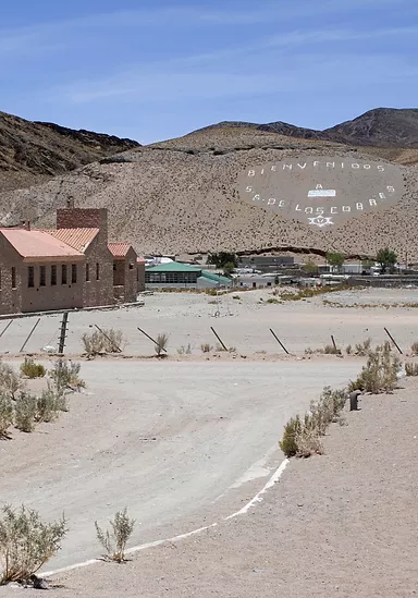
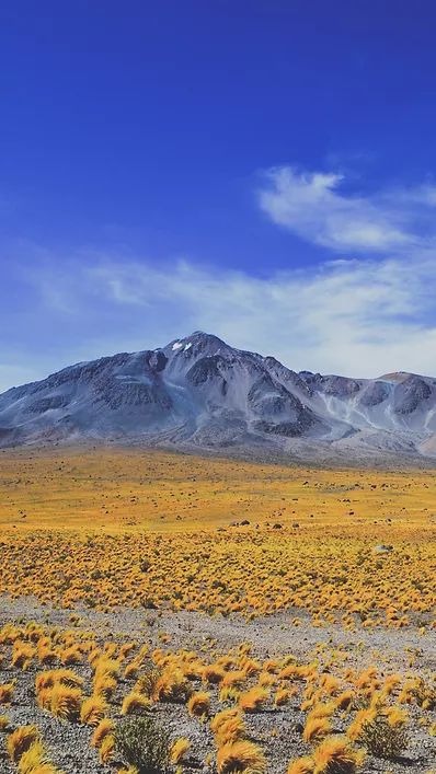
San Antonio de los Cobres is the actual Capital of the Puna, a dusty village with a colored community, our last point of
civilization and the arrival point of most tourists. Abra Chorrillos will be our highest point and there we will learn
about the Apacheta and its cultural importance for the Andean traditions. After the crossing of the geologically dying
Salt lake of Pocitos, a 3-hour drive in wild and untouched nature begins. The Labyrinth Desert, a 10 million–year fossil
dune desert, is formed by clay picks and gypsum crystals. Nowadays, it is possible to drive across this natural wonder,
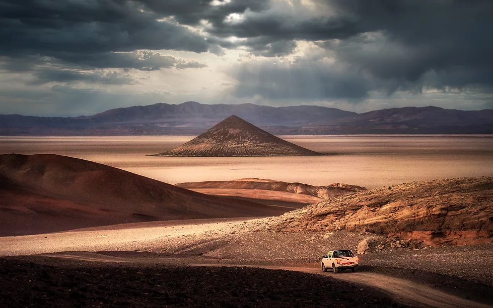
a must for photo safari lovers. Tolar Grande lies at the border of a giant depression, the Salar de Arizaro; one of the
biggest salt flats in the planet, and from this tiny old railway village built in 1940 there is a unique view over the
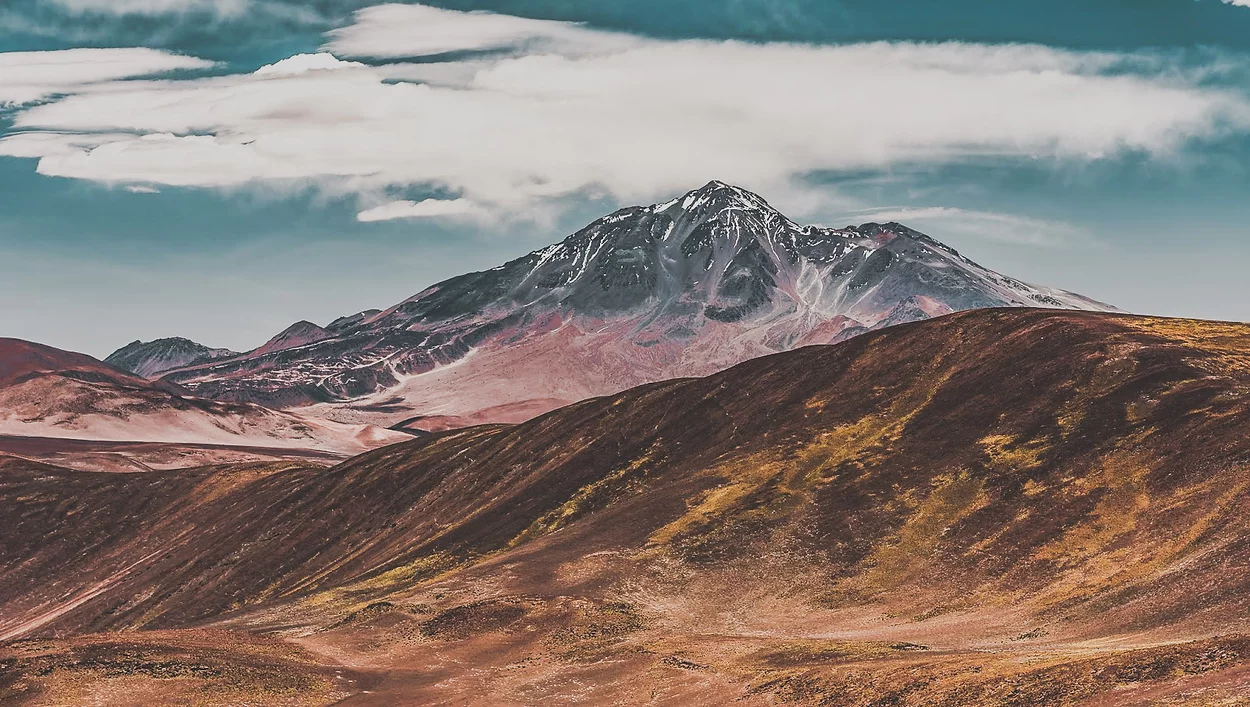
western ridge of the Cordillera, an infinite skyline of Volcanoes higher than 6.000 meters
Tolar grande | Salar de Arizano | Cono de Arita | Oasis de Antofallita & Antofalla | Vega Colorada | Quebrada de Calalaste | Antofagasta de la Sierra | El Peñón
Estimated driving time: 7 hs. |Distance: 340 km earth track and salt road. | Altitude: Highest point 4.500 m./ 14.764 feet. El Peñón 3.400 m. / 11.155 feet. | Meals Included: Breakfast.
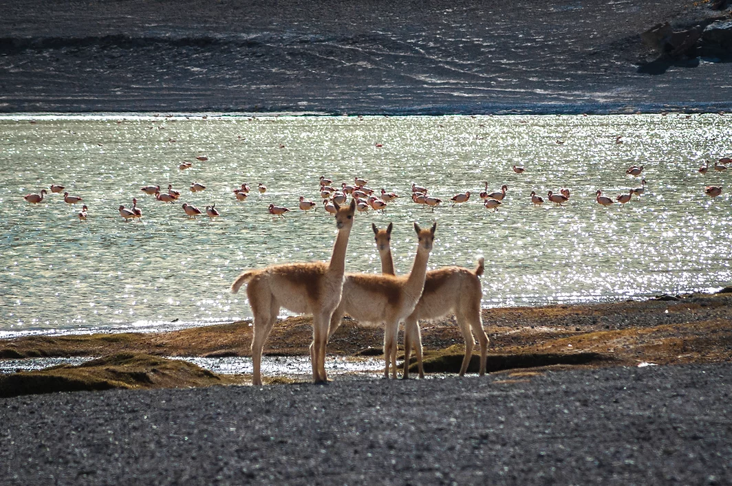
The crossing of the Arizaro Salted dry lake resembles the ancient journey of the Arrieros (shepherds guiding caravans of animals to Chile). Arizaro, meaning Vultures Cemetery, comes from a period when many animals (cows and horses) perished during the crossing of the salt flat. Antofalla is an important and spectacular example of a Puna Oasis; in the middle of a high altitude desert there is a green valley, thanks to a natural pure water spring, full of Poplar, Molle and Willow trees. Antofalla, together with Antofagasta and Santa Rosa, were important stations for Llama caravans connecting this part of the Andes with the Oasis of Atacama. The Oasis is located just at the border of the longest salt flat in the world, among red mountains and lava strips. Antofalla is still inhabited by a tiny community of 60 people, they are all shepherds. We will stop for lunch, and then travel across the colored mirror of the salt lake. Above 4.200 meters with wide views over the Antofalla Volcano (6.400 mts) lays a kind of green field (Vega Colorada) home of llamas, suris (Andean ostrich), wild donkeys and vicuñas. The valley of Calalaste, just a few kilometers away from Vega Colorada is the best spot to find wild camelids. Antofagasta de la Sierra, was the biggest Oasis on the path connecting this side of the Andes with the Oasis of San Pedro de Atacama (Chile), it is a big village with more than 2.000 people who maintain their ancient traditions and culture. The name Antofagasta means “place where the sun shines” and it is surrounded by uncountable Volcanic Peaks.
El Peñón | Volcan & Laguna Carachi Pampa | Campo de Piedra Pómez | Dunas Blancas | El Peñón
Estimated driving time: 4 1/2 hs. | Distance: : 130 km of earth, gravel and salt tracks. | Altitude: Highest point 4.200 m./ 13.780 feet. El Peñón 3.400 m. / 11.155 feet. | Meals Included: Box Lunch.
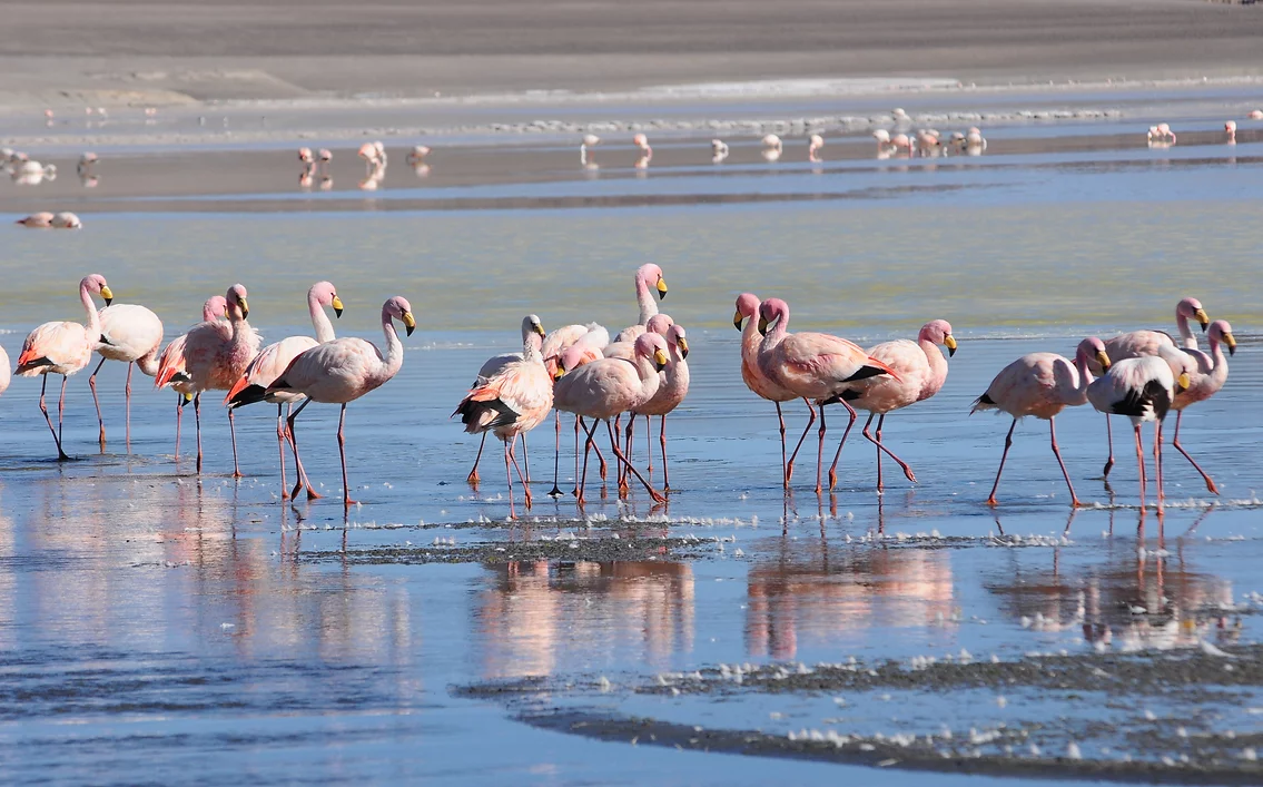
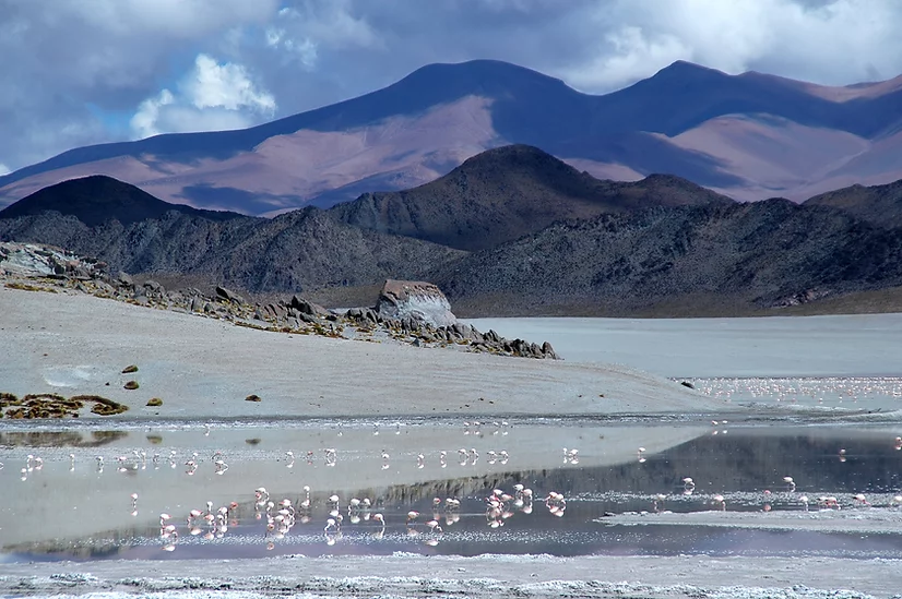
Our adventure starts today at the edge of Campo de Piedra Pómez, as we reach the Carachi Pampa basin, in its
margins there is a volcano of the same name, surrounded by black lava fields and a lagoon, where the Andean
flamingo, and the James’ (or puna) flamingo can be found. During the dry season a small salt lake is formed around
the lagoon. Later, our journey will continue into the Natural Reserve Campo de Piedra Pómez, a strange and stunning
landscape carved into the rock that gives rise to its name: The Pumice. Of purely igneous origin, it was produced from
a massive explosion of the volcanic stratum. This cloud has spread the ashes and debris in large areas and in different
directions, which crystallized by the effects of the temperature giving shape to these wonderful rocks with special
features and with plenty of holes produced by the escape of gases during the chilling stage.This degassing
phenomenon made the rock very easy to carve by the winds of the Puna, arid and harsh winds that move freely
through the region, becoming the best and most prominent Andean rock sculptors. This strange landscape of white
labyrinths and climbing sand dunes is located a few miles to the west, on a track where the path continues through
some sand that we could describe as the dream of the explorer, an overlanding adventure. Return to the Hotel, just in
time to enjoy stunning sunset views from the village.
El Peñon | Laguna Grande | Cerro Galán Caldera | Laguna Diamante | El Peñón
Estimated driving time: 8 hs. |Distance: 120 km dirt path and gravel road, 60 km paved road (EL Peñón-Antofagasta) . | Altitude: Highest point 5.000 m./ 16.404 feet. El Peñón 3.400 m. / 11.155 feet.| Meals Included: Box Lunch.
Season: from October to April With an early start, we will drive in direction to Antofagasta de la Sierra as we enter the región of Real Grande (4050 meters), where traces of the first settlements of the Puna can be found in ancient petroglyphs, dated 10000 B.P. and entrance point to Cerro Galán Caldera from the Northwest. Cerro Galán, is one the world’s largest volcanic calderas and greatest of the Andes Mountains, its dimensions are 34 km from north to south and 24 km from east to west, and it is the result of an extreme plinian eruption that occurred 2.2 million years ago. Its identification as a volcanic caldera was performed using satellite photographs, since its elliptical shape is too large to be able to be appreciated from the ground. Its walls reach 5,000 meters of altitude and the central peak 5,912 meters, while its floor is at 4,500 meters of altitude. The Caldera contains a lake in its south western corner, known as Laguna Diamante, which is home to flamingos and ducks, protected from the wind by the walls, in this extremely harsh environment. Our path will lead us to another high altitude Andean lake, known as Laguna Grande Reserve, a saline lake that sits at an altitude of 4150 meters. During winter, the water freezes completely, but when spring arrives, it becomes the largest gathering center of the Puna flamingo birds, also called Small Parina (Phoenicopterus jamesi), with more than 19,000 birds (25% of the known total population). It is also a place for summer congregation for the Andean flamingo (Phoenicopterus andinus) and it is a common nesting site of Southern flamenco (Phoenicopterus chilensis). We will drive to El Peñón with the perfect warm light of sunset.
El Peñón | Hualfin | Santa María | Cafayate | Quebrada de las Conchas | Salta
Estimated driving time: 7 hs. | Distance: : 440 km paved road. 50 km gravel road. | Altitude: Highest point 4.100 m./ 13.451 feet. Salta 1.200 m. / 3.937 feet. | Meals Included: Breakfast.
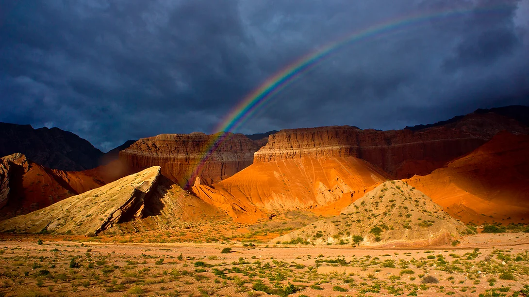
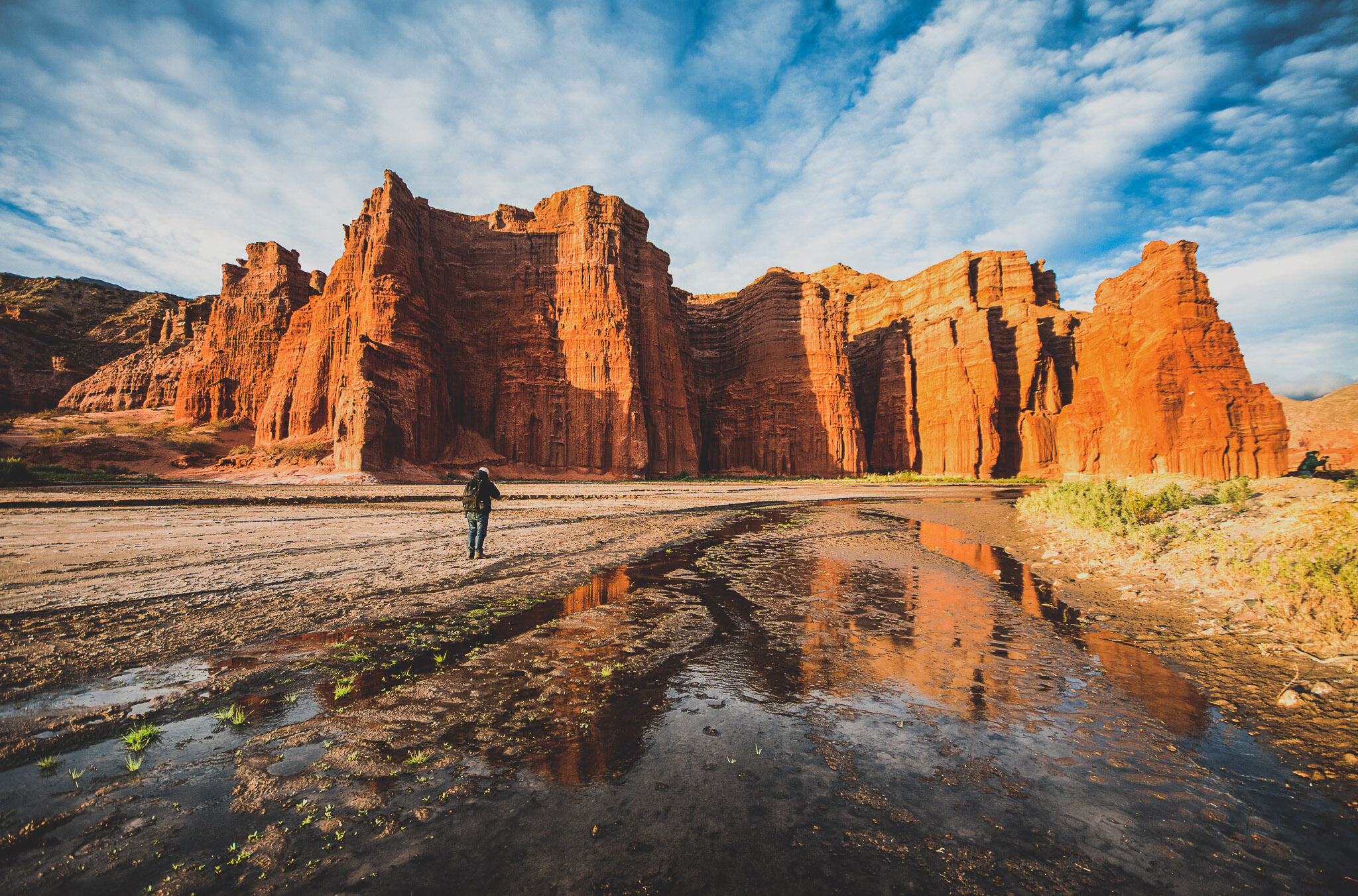
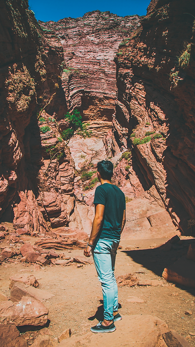
After days of intense travel on the High Desert Plateau, the North West still has plenty of surprises. The paved road from El Peñón to meet Route 40 is a 150 km long yellow field of Paja Brava, white lagoons and a deserted narrow canyon filled with rich vegetation. Then, we will make a quick stop in Cafayate, a pleasant town surrounded by green vineyards. In the afternoon with the best light of the day we’ll go across the Quebrada de las Conchas Gorge, 55 km of scenic sedimentary rock formations, dated from forty to a hundred million years old, with geological formations as the Yacoraite or the Pirguas of great importance. Salta and its green valley will welcome us after five days of unique adventure.
Quebrada de las Conchas, Socompa
Quebrada de las Conchas, Socompa
Quebrada de las Conchas | Socompa
Quebrada de las Conchas, Socompa
Quebrada de las conchas, A beautiful scene of stone walls and reflections in the water.
Qebrada de las conchas
Quebrada de las conchas, beautiful and colorful mountains